Geolocate

Kaup topographic map

Click on the map to display elevation.

About this map
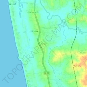
Name: Kaup topographic map, elevation, terrain.

Location: Kaup, Udupi taluku, Udupi district, Karnataka, 574106, India (13.21068 74.72840 13.25068 74.76840)

Average elevation: 10 m

Minimum elevation: 0 m

Maximum elevation: 38 m

Gear up for your next adventure:

🍳Camping Cookware - Cookware sets for outdoor meals
🎧Bluetooth Outdoor Earbuds - Listen to navigation cues or podcasts during long solo treks
🦟Heavy Duty Insect Repellent - Essential protection against flies, mozzies, and march flies
📍Handheld GPS - GPS devices for hiking and navigation
🥾Trail Running Shoes - Shoes for trail running

As an Amazon Associate, this site earns from qualifying purchases at no extra cost to you.