Geolocate

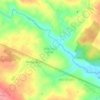
Lagoa do Barro topographic map

Click on the map to display elevation.

About this map

Name: Lagoa do Barro topographic map, elevation, terrain.

Location: Lagoa do Barro, Araripina, Região Geográfica Imediata de Araripina, Região Geográfica Intermediária de Petrolina, Pernambuco, Região Nordeste, Brasil (-7.82492 -40.48305 -7.69112 -40.35330)

Average elevation: 536 m

Minimum elevation: 466 m

Maximum elevation: 644 m

Other topographic maps

Click on a map to view its topography, its elevation and its terrain.

Sítio São Paulo

Brasil > Pernambuco > Araripina

Average elevation: 713 m

Serra da Torre

Brasil > Pernambuco > Araripina

Average elevation: 745 m

Sítio Santa Cruz

Brasil > Pernambuco > Araripina

Average elevation: 600 m

Chapada do Araripe

Brasil > Pernambuco > Araripina

Average elevation: 757 m

Chapada do Araripe

Brasil > Pernambuco > Araripina

Average elevation: 716 m

Chapada do Araripe

Brasil > Pernambuco > Araripina

Average elevation: 751 m

Gear up for your next adventure:

🎽Hiking Clothing - Breathable clothing for hiking
🧺Fast-Dry Microfiber Towels - Large towels that pack down to the size of an orange
🧦Hiking Socks - Comfortable socks for long hikes
🧊Insulated Stainless Steel Flasks - Keep water cold for 24 hours in the heat or coffee hot in the cold
👕UPF 50+ Sun Shirts - Essential protection against the harsh Australian sun during field work

As an Amazon Associate, this site earns from qualifying purchases at no extra cost to you.