
Fabreville topographic map
Interactive map
Click on the map to display elevation.
About this map
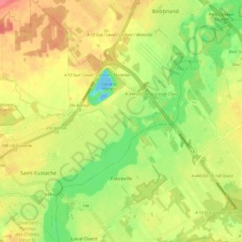
Name: Fabreville topographic map, elevation, terrain.
Location: Fabreville, Laval (région administrative), Québec, Canada (45.54957 -73.87253 45.61047 -73.76902)
Average elevation: 32 m
Minimum elevation: -18 m
Maximum elevation: 59 m
Other topographic maps
Click on a map to view its topography, its elevation and its terrain.
Parc Mont-Royal
Canada > Québec > Laval (région administrative)
Parc Mont-Royal, Sainte-Rose, Laval (région administrative), Québec, Canada
Average elevation: 31 m
Duvernay
Canada > Québec > Laval (région administrative)
Duvernay, Laval (région administrative), Québec, Canada
Average elevation: 34 m
Saint-François
Canada > Québec > Laval (région administrative)
Saint-François, Laval (région administrative), Québec, Canada
Average elevation: 24 m