
Bắc Sơn topographic map
Interactive map
Click on the map to display elevation.
About this map
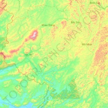
Name: Bắc Sơn topographic map, elevation, terrain.
Location: Bắc Sơn, Province de Lạng Sơn, Viêt Nam (21.66271 106.09538 21.95992 106.41840)
Average elevation: 374 m
Minimum elevation: 36 m
Maximum elevation: 1,084 m
Other topographic maps
Click on a map to view its topography, its elevation and its terrain.
Province de Lạng Sơn
Viêt Nam > Province de Lạng Sơn
Province de Lạng Sơn, Viêt Nam
Average elevation: 441 m