
Kiduru Cell topographic map
Interactive map
Click on the map to display elevation.
About this map
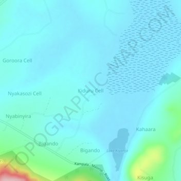
Name: Kiduru Cell topographic map, elevation, terrain.
Location: Kiduru Cell, Masindi, Western Region, Uganda (1.64416 31.77879 1.68416 31.81879)
Average elevation: 1,099 m
Minimum elevation: 1,075 m
Maximum elevation: 1,280 m