
Walkenried topographic map
Interactive map
Click on the map to display elevation.
About this map
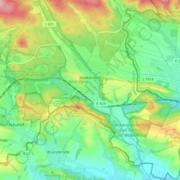
Name: Walkenried topographic map, elevation, terrain.
Location: Walkenried, Landkreis Göttingen, Nedersaksen, 37445, Duitsland (51.55823 10.58114 51.61065 10.66613)
Average elevation: 289 m
Minimum elevation: 237 m
Maximum elevation: 383 m