
Pampa Yurac topographic map
Interactive map
Click on the map to display elevation.
About this map
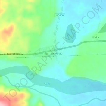
Name: Pampa Yurac topographic map, elevation, terrain.
Location: Pampa Yurac, Padre Abad, Ucayali, Perú (-9.07954 -75.65591 -9.03954 -75.61591)
Average elevation: 378 m
Minimum elevation: 331 m
Maximum elevation: 520 m
Other topographic maps
Click on a map to view its topography, its elevation and its terrain.
Aguaytía
Perú > Ucayali > Padre Abad > Aguaytía
Aguaytía, Padre Abad, Provincia de Padre Abad, Ucayali, Perú
Average elevation: 312 m
Previsto
Perú > Ucayali > Padre Abad > Previsto
Previsto, Padre Abad, Provincia de Padre Abad, Ucayali, Perú
Average elevation: 945 m
Provincia de Padre Abad
Perú > Ucayali > Padre Abad
Provincia de Padre Abad, Padre Abad, Ucayali, Perú
Average elevation: 269 m