Geolocate

Davison topographic map

Click on the map to display elevation.

About this map

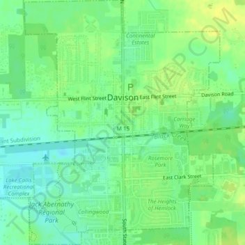
Name: Davison topographic map, elevation, terrain.

Location: Davison, Genesee County, Michigan, 48423, United States (43.01825 -83.53309 43.04555 -83.50322)

Average elevation: 243 m

Minimum elevation: 233 m

Maximum elevation: 251 m

Gear up for your next adventure:

👖Convertible Hiking Trousers - Zip-off legs to adapt to changing temperatures throughout the day
🍴Titanium Spork & Cutlery - Indestructible and feather-light eating utensils
🧥Thermal Emergency Blankets - Compact Mylar blankets to prevent hypothermia if stranded overnight
🔋Solar Power Banks - Charge your phone and GPS using the sun while deep in the bush
🧯Animal Deterrent Spray - Safety spray for wildlife

As an Amazon Associate, this site earns from qualifying purchases at no extra cost to you.