Geolocate

Ligma topographic map

Click on the map to display elevation.

About this map

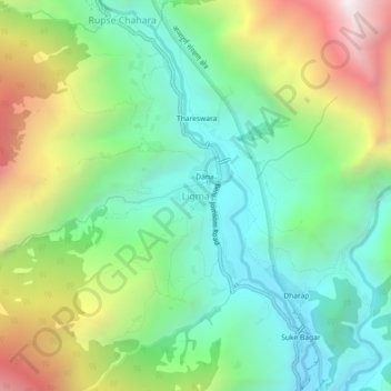
Name: Ligma topographic map, elevation, terrain.

Location: Ligma, Dana, Annapurna, Myagdi, Gandaki Pradesh, Nepal (28.51750 83.62695 28.55750 83.66695)

Average elevation: 1,875 m

Minimum elevation: 1,309 m

Maximum elevation: 2,958 m

Gear up for your next adventure:

🧢Wide Brim Sun Hats - Maximum coverage for the face and neck while out in the open
🎧Bluetooth Outdoor Earbuds - Listen to navigation cues or podcasts during long solo treks
📱Tablet Tripod Mounts - Steady platforms for viewing digital maps or taking long exposures
🔋Solar Power Banks - Solar chargers for outdoors
🪢550 Survival Paracord - Versatile cordage for gear repair and emergency lashing

As an Amazon Associate, this site earns from qualifying purchases at no extra cost to you.