
Vesanto topographic map
Interactive map
Click on the map to display elevation.
About this map
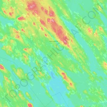
Name: Vesanto topographic map, elevation, terrain.
Average elevation: 116 m
Minimum elevation: 92 m
Maximum elevation: 220 m
Other topographic maps
Click on a map to view its topography, its elevation and its terrain.
Varkaus
Varkaus, Varkaus sub-region, North Savo, Regional State Administrative Agency for Eastern Finland, Mainland Finland, Finland
Average elevation: 100 m