
Comuna 1 topographic map
Interactive map
Click on the map to display elevation.
About this map
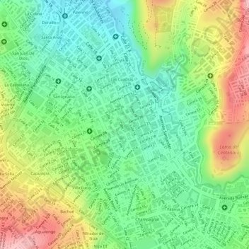
Name: Comuna 1 topographic map, elevation, terrain.
Average elevation: 2,562 m
Minimum elevation: 2,492 m
Maximum elevation: 2,661 m
Other topographic maps
Click on a map to view its topography, its elevation and its terrain.
Comuna 4
Colombia > Nariño > Pasto > Perímetro Urbano Pasto
Comuna 4, Perímetro Urbano Pasto, Pasto, Centro, Nariño, Colombia
Average elevation: 2,606 m