Geolocate

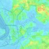
Geestenseth topographic map

Click on the map to display elevation.

About this map

Name: Geestenseth topographic map, elevation, terrain.

Location: Geestenseth, Schiffdorf, Landkreis Cuxhaven, Lower Saxony, Germany (53.48799 8.83801 53.52799 8.87801)

Average elevation: 7 m

Minimum elevation: -3 m

Maximum elevation: 18 m

Other topographic maps

Click on a map to view its topography, its elevation and its terrain.
Steinau

Germany > Lower Saxony > Landkreis Cuxhaven

Average elevation: 0 m

27624

Germany > Lower Saxony > Landkreis Cuxhaven > Geestland

Average elevation: 5 m

Geestland

Germany > Lower Saxony > Landkreis Cuxhaven

Average elevation: 3 m

Nordholz

Germany > Lower Saxony > Landkreis Cuxhaven

Average elevation: 7 m

27607

Germany > Lower Saxony > Landkreis Cuxhaven > Geestland

Average elevation: 7 m

Belum

Germany > Lower Saxony > Landkreis Cuxhaven

Average elevation: 0 m

Spaden

Germany > Lower Saxony > Landkreis Cuxhaven

Average elevation: 4 m

Wanna

Germany > Lower Saxony > Landkreis Cuxhaven

Average elevation: 2 m

Dorum

Germany > Lower Saxony > Landkreis Cuxhaven

Average elevation: 3 m

Cuxhaven

Germany > Lower Saxony > Landkreis Cuxhaven

Average elevation: 3 m

27616

Germany > Lower Saxony > Landkreis Cuxhaven > Beverstedt

Average elevation: 11 m

27607

Germany > Lower Saxony > Landkreis Cuxhaven > Geestland

Average elevation: 7 m

21776

Germany > Lower Saxony > Landkreis Cuxhaven > Wanna > Haubusch

Average elevation: 1 m

Gear up for your next adventure:

🧯Animal Deterrent Spray - Safety spray for wildlife
🍶Collapsible Water Bottles - Save space in your pack as you consume your water supply
🛌Sleeping Mats - Insulated mats for camping comfort
🛌Compact Down Sleeping Bags - Warmth without the bulk, ideal for backcountry camping
⛺Ultralight Solo Tents - Compact shelters for multi-day topographic surveying expeditions

As an Amazon Associate, this site earns from qualifying purchases at no extra cost to you.