
제주시 topographic map
Interactive map
Click on the map to display elevation.
About this map
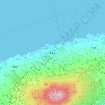
Name: 제주시 topographic map, elevation, terrain.
Location: 제주시, Jeju, 63183, Coreia do Sul (33.33306 126.35306 33.65306 126.67306)
Average elevation: 263 m
Minimum elevation: -1 m
Maximum elevation: 1,919 m