Geolocate

Bothwell topographic map

Click on the map to display elevation.

About this map

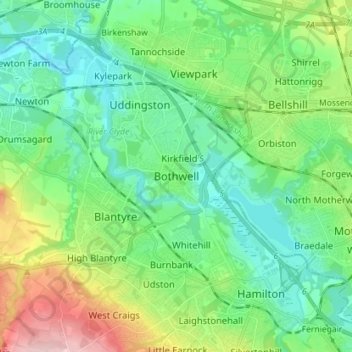
Name: Bothwell topographic map, elevation, terrain.

Location: Bothwell, South Lanarkshire, Scotland, G71 8RB, United Kingdom (55.76266 -4.10770 55.84266 -4.02770)

Average elevation: 65 m

Minimum elevation: 10 m

Maximum elevation: 209 m

Gear up for your next adventure:

🔥Ferrocerium Rod Fire Starters - Reliable fire lighting in wet or windy conditions without matches
👄SPF Lip Balm - Prevent sun and wind-burnt lips on mountain ridges
🦯Trekking Poles - Walking poles for hiking stability
🔦LED Torches - LED torches for outdoor use
👟Lightweight Trail Runners - Agile footwear for fast movement over rugged Australian terrain

As an Amazon Associate, this site earns from qualifying purchases at no extra cost to you.