Geolocate

McAllen topographic map

Click on the map to display elevation.

About this map

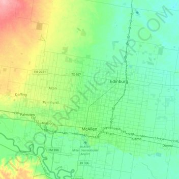
Name: McAllen topographic map, elevation, terrain.

Location: McAllen, Hidalgo County, Texas, United States (26.10213 -98.31806 26.46666 -98.19539)

Average elevation: 40 m

Minimum elevation: 16 m

Maximum elevation: 113 m

Gear up for your next adventure:

🧥Down Jackets - Insulated jackets for cold weather
🧥Softshell Jackets - Flexible outdoor jackets
🧭Global Orienteering Compass - High-precision liquid-filled compasses for accurate map reading and navigation
Altimeter Barometer Watches - Outdoor watches with built-in sensors to track altitude changes and weather shifts
🔪Outdoor Multi-tools - Versatile tools for gear repair and survival tasks in the wilderness

As an Amazon Associate, this site earns from qualifying purchases at no extra cost to you.