
Plaines d'Abraham topographic map
Interactive map
Click on the map to display elevation.
About this map
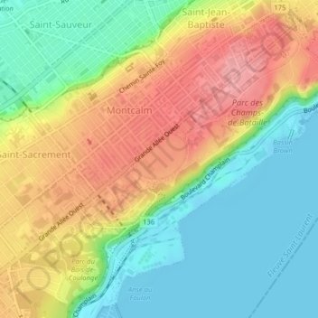
Name: Plaines d'Abraham topographic map, elevation, terrain.
Average elevation: 47 m
Minimum elevation: -2 m
Maximum elevation: 109 m
Other topographic maps
Click on a map to view its topography, its elevation and its terrain.
Lac Bonhomme
Lac Bonhomme, Chemin du Lac-Bonhomme, Val-Bélair, Québec, Québec (Agglomération), Capitale-Nationale, Québec, G3J 0A6, Canada
Average elevation: 299 m
Pointe-de-Sainte-Foy
Pointe-de-Sainte-Foy, Sainte-Foy–Sillery–Cap-Rouge, Québec, Québec (Agglomération), Capitale-Nationale, Québec, Canada
Average elevation: 53 m
Neufchâtel-Est–Lebourgneuf
Neufchâtel-Est–Lebourgneuf, Québec, Québec (Agglomération), Capitale-Nationale, Québec, Canada
Average elevation: 91 m