
Club de Plein Air Saint Adolphe d'Howard topographic map
Interactive map
Click on the map to display elevation.
About this map
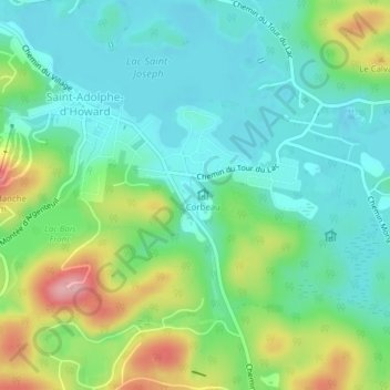
Name: Club de Plein Air Saint Adolphe d'Howard topographic map, elevation, terrain.
Average elevation: 399 m
Minimum elevation: 357 m
Maximum elevation: 497 m
Other topographic maps
Click on a map to view its topography, its elevation and its terrain.
Saint-Adolphe-d'Howard
Canada > Quebec > Les Pays-d'en-Haut > Saint-Adolphe-d'Howard
Saint-Adolphe-d'Howard, Les Pays-d'en-Haut, Laurentides, Quebec, J0T 2B0, Canada
Average elevation: 424 m