Geolocate

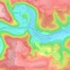
Weiler topographic map

Click on the map to display elevation.

About this map

Name: Weiler topographic map, elevation, terrain.

Location: Weiler, Blaubeuren, Gemeindeverwaltungsverband Blaubeuren, Alb-Donau-Kreis, Baden-Württemberg, Germany (48.36805 9.72484 48.40732 9.79323)

Average elevation: 621 m

Minimum elevation: 502 m

Maximum elevation: 715 m

Other topographic maps

Click on a map to view its topography, its elevation and its terrain.
Gear up for your next adventure:

🦯Adjustable Trekking Poles - Reduce impact on knees when descending steep topographic ridges
🍴Titanium Spork & Cutlery - Indestructible and feather-light eating utensils
🔦LED Torches - LED torches for outdoor use
🌧️Rain Jackets - Waterproof jackets for hiking
⌚Altimeter Barometer Watches - Outdoor watches with built-in sensors to track altitude changes and weather shifts

As an Amazon Associate, this site earns from qualifying purchases at no extra cost to you.