
Niagara Falls State Park topographic map
Interactive map
Click on the map to display elevation.
About this map
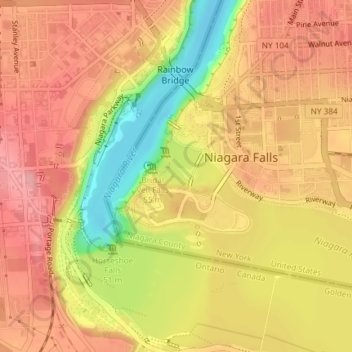
Name: Niagara Falls State Park topographic map, elevation, terrain.
Average elevation: 169 m
Minimum elevation: 97 m
Maximum elevation: 209 m
Other topographic maps
Click on a map to view its topography, its elevation and its terrain.
American Falls
États-Unis d'Amérique > New York > Niagara Falls
American Falls, Niagara Falls, Niagara County, New York, NY 14303, États-Unis d'Amérique
Average elevation: 170 m