Geolocate

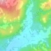
Meadowvale topographic map

Click on the map to display elevation.

About this map

Name: Meadowvale topographic map, elevation, terrain.

Location: Meadowvale, Municipality of Colchester, Colchester County, Nova Scotia, Canada (45.14372 -63.05206 45.20604 -62.96649)

Average elevation: 102 m

Minimum elevation: 16 m

Maximum elevation: 197 m

Other topographic maps

Click on a map to view its topography, its elevation and its terrain.

Gear up for your next adventure:

🍴Titanium Spork & Cutlery - Indestructible and feather-light eating utensils
👄SPF Lip Balm - Prevent sun and wind-burnt lips on mountain ridges
🦘Outback Survival Gear - Essential gear for Australian outback
🏃Compression Recovery Socks - Reduce leg fatigue after heavy days of elevation gain
🧦Merino Wool Hiking Socks - Moisture-wicking socks to prevent blisters during long topographic surveys

As an Amazon Associate, this site earns from qualifying purchases at no extra cost to you.