Geolocate

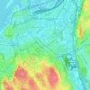
Ramberget topographic map

Click on the map to display elevation.

About this map

Name: Ramberget topographic map, elevation, terrain.

Location: Ramberget, Gothenburg, Göteborgs Stad, Västra Götaland County, 417 13, Sweden (57.71453 11.93615 57.71463 11.93625)

Average elevation: 15 m

Minimum elevation: -2 m

Maximum elevation: 83 m

Other topographic maps

Click on a map to view its topography, its elevation and its terrain.

Olivedal

Sweden > Västra Götaland County > Gothenburg

Average elevation: 26 m

Utby

Sweden > Västra Götaland County > Gothenburg

Average elevation: 41 m

Heden

Sweden > Västra Götaland County > Gothenburg

Average elevation: 24 m

Gear up for your next adventure:

🔥Windproof Plasma Lighters - USB rechargeable lighters that work in high-altitude winds
🔦LED Torches - LED torches for outdoor use
🪑Portable Backpacking Chairs - A comfortable seat for studying maps at the end of the day
👄SPF Lip Balm - Prevent sun and wind-burnt lips on mountain ridges
🪫Rechargeable Headlamps - USB rechargeable headlamps

As an Amazon Associate, this site earns from qualifying purchases at no extra cost to you.