
Eglinton Island topographic map
Interactive map
Click on the map to display elevation.
About this map
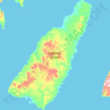
Name: Eglinton Island topographic map, elevation, terrain.
Location: Eglinton Island, Northwest Territories, Canada (75.50300 -119.40700 76.12825 -117.44175)
Average elevation: 20 m
Minimum elevation: -3 m
Maximum elevation: 308 m
Other topographic maps
Click on a map to view its topography, its elevation and its terrain.