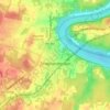
Egypt topographic map
Click on the map to display elevation.
About this map
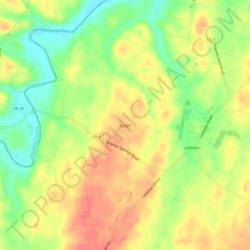
Name: Egypt topographic map, elevation, terrain.
Location: Egypt, Jefferson County, West Virginia, 25430, United States (39.33204 -77.96750 39.37204 -77.92750)
Average elevation: 151 m
Minimum elevation: 118 m
Maximum elevation: 177 m
Other topographic maps
Click on a map to view its topography, its elevation and its terrain.
Harpers Ferry
United States > West Virginia > Jefferson County
The town was "easy to seize, and hard to hold", because of its topography: surrounded on three sides by high ground – Bolivar Heights to the west, Loudoun Heights to the south, and Maryland Heights to the east – and surrounded by the Potomac and Shenandoah Rivers, anyone who controlled the heights…
Average elevation: 174 m

Charles Town
United States > West Virginia > Jefferson County
Due to its low elevation for West Virginia, Charles Town is on the northern extent of the Humid Subtropical climate zone, having cool to mildly cold winters and hot and humid summers. Precipitation is evenly distributed throughout the year, providing lush, abundant plant growth.
Average elevation: 150 m

Harpers Ferry
United States > West Virginia > Jefferson County
The town was "easy to seize, and hard to hold", because of its topography: surrounded on three sides by high ground – Bolivar Heights to the west, Loudoun Heights to the south, and Maryland Heights to the east – and surrounded by the Potomac and Shenandoah Rivers, anyone who controlled the heights…
Average elevation: 174 m
Harpers Ferry
United States > West Virginia > Jefferson County
The town was "easy to seize, and hard to hold", because of its topography: surrounded on three sides by high ground (Bolivar Heights to the west, Loudoun Heights to the south, and Maryland Heights to the east) and the Potomac and Shenandoah Rivers, anyone who controlled the heights controlled the city.
Average elevation: 174 m

Charles Town
United States > West Virginia > Jefferson County
Due to its low elevation for West Virginia, Charles Town is on the northern extent of the Humid Subtropical climate zone, having cool to mildly cold winters and hot and humid summers. Precipitation is evenly distributed throughout the year, providing lush, abundant plant growth.
Average elevation: 150 m
Harpers Ferry
United States > West Virginia > Jefferson County
The town was "easy to seize, and hard to hold", because of its topography: surrounded on three sides by high ground (Bolivar Heights to the west, Loudoun Heights to the south, and Maryland Heights to the east) and the Potomac and Shenandoah Rivers, anyone who controlled the heights controlled the city.
Average elevation: 174 m