
La Boquilla topographic map
Interactive map
Click on the map to display elevation.
About this map
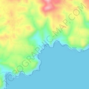
Name: La Boquilla topographic map, elevation, terrain.
Location: La Boquilla, San Pedro Pochutla, Oaxaca, Mexico (15.68259 -96.46594 15.68381 -96.46429)
Average elevation: 69 m
Minimum elevation: 0 m
Maximum elevation: 199 m
Other topographic maps
Click on a map to view its topography, its elevation and its terrain.
Puerto Ángel
Mexico > Oaxaca > San Pedro Pochutla
Puerto Ángel, San Pedro Pochutla, Oaxaca, 70902, Mexico
Average elevation: 43 m