Geolocate

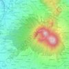
Ubrug topographic map

Click on the map to display elevation.

About this map

Name: Ubrug topographic map, elevation, terrain.

Location: Ubrug, Sukabumi, West Java, 43115, Indonesia (-6.97412 106.73072 -6.93412 106.77072)

Average elevation: 300 m

Minimum elevation: 220 m

Maximum elevation: 399 m

Other topographic maps

Click on a map to view its topography, its elevation and its terrain.

Situ Gunung

Indonesia > West Java > Sukabumi > Kadudampit

Average elevation: 1,039 m

Cibodas

Indonesia > West Java > Sukabumi > Cimenteng

Average elevation: 260 m

Cikahuripan

Indonesia > West Java > Sukabumi

Average elevation: 110 m

Cisolok

Indonesia > West Java > Sukabumi

Average elevation: 62 m

Gear up for your next adventure:

🛰️Handheld GPS Units - Rugged GPS devices for tracking coordinates and elevation in the Australian bush
🔥Windproof Plasma Lighters - USB rechargeable lighters that work in high-altitude winds
🧼Clip-on Hand Sanitizer - Maintain hygiene when water for washing is scarce
📣High-Decibel Survival Whistles - Signaling tool for rescue that carries much further than a human voice
☕Outdoor Coffee Makers - Enjoy quality coffee at the summit of your favorite peak

As an Amazon Associate, this site earns from qualifying purchases at no extra cost to you.