
Thank you for supporting this site ❤️
Make a donation
Make a donation
Gear up for your next adventure:
As an Amazon Associate, this site earns from qualifying purchases at no extra cost to you.
Lumsden topographic map
Click on the map to display elevation.
Thank you for supporting this site ❤️
Make a donation
Make a donation
Gear up for your next adventure:
As an Amazon Associate, this site earns from qualifying purchases at no extra cost to you.
About this map
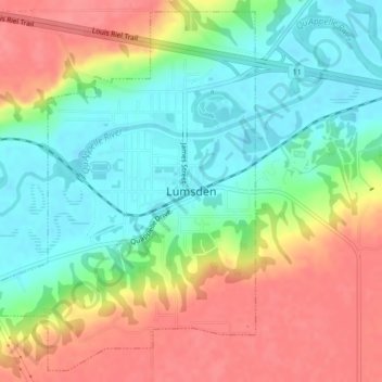
Name: Lumsden topographic map, elevation, terrain.
Location: Lumsden, Division No. 6, Saskatchewan, S0G 3C0, Canada (50.63361 -104.89334 50.65898 -104.85878)
Average elevation: 527 m
Minimum elevation: 493 m
Maximum elevation: 567 m
Thank you for supporting this site ❤️
Make a donation
Make a donation
Gear up for your next adventure:
As an Amazon Associate, this site earns from qualifying purchases at no extra cost to you.