
Poll topographic map
Interactive map
Click on the map to display elevation.
About this map
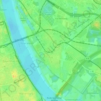
Name: Poll topographic map, elevation, terrain.
Location: Poll, Porz, Cologne, North Rhine-Westphalia, 51105, Germany (50.89923 6.97334 50.92909 7.01705)
Average elevation: 48 m
Minimum elevation: 35 m
Maximum elevation: 67 m
Other topographic maps
Click on a map to view its topography, its elevation and its terrain.
Niehl
Germany > North Rhine-Westphalia > Cologne > Merkenich
Niehl, Nippes, Merkenich, Cologne, Cologne Government Region, North Rhine-Westphalia, 50735, Germany
Average elevation: 46 m