
Petra District topographic map
Interactive map
Click on the map to display elevation.
About this map
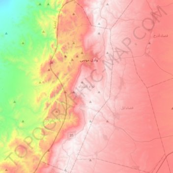
Name: Petra District topographic map, elevation, terrain.
Location: Petra District, Maan, Jordan (30.12791 35.38402 30.42317 35.52875)
Average elevation: 1,130 m
Minimum elevation: 161 m
Maximum elevation: 1,733 m
Other topographic maps
Click on a map to view its topography, its elevation and its terrain.