
Thank you for supporting this site ❤️
Make a donation
Make a donation
Gear up for your next adventure:
As an Amazon Associate, this site earns from qualifying purchases at no extra cost to you.
Galalan topographic map
Click on the map to display elevation.
Thank you for supporting this site ❤️
Make a donation
Make a donation
Gear up for your next adventure:
As an Amazon Associate, this site earns from qualifying purchases at no extra cost to you.
About this map
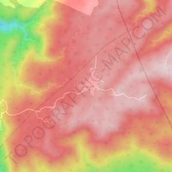
Name: Galalan topographic map, elevation, terrain.
Location: Galalan, Pangil, Laguna, Calabarzon, 4019, Philippines (14.42353 121.48522 14.46353 121.52522)
Average elevation: 417 m
Minimum elevation: 139 m
Maximum elevation: 514 m
Thank you for supporting this site ❤️
Make a donation
Make a donation
Gear up for your next adventure:
As an Amazon Associate, this site earns from qualifying purchases at no extra cost to you.