

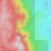
Manitou Springs topographic map
Click on the map to display elevation.
About this map
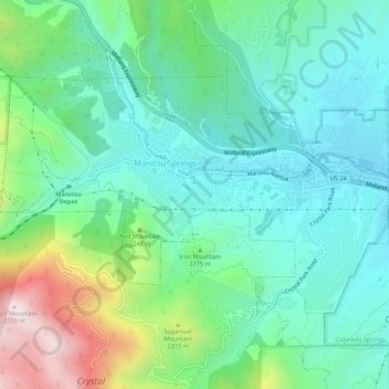
Name: Manitou Springs topographic map, elevation, terrain.
Average elevation: 2,144 m
Minimum elevation: 1,891 m
Maximum elevation: 2,795 m
Other topographic maps
Click on a map to view its topography, its elevation and its terrain.
Pikes Peak
United States > Colorado > El Paso County
Pikes Peak or America's Mountain is an ultra-prominent fourteener of the Front Range of the Rocky Mountains of North America. Pikes Peak's summit has an elevation of 14,115 ft (4,302 m) above sea level. Pikes Peak is in Pike National Forest, Colorado, with the base located in the town of Manitou Springs, 10…
Average elevation: 3,902 m
Pikes Peak
United States > Colorado > El Paso County
The uppermost portion of Pikes Peak, above 14,000 feet (4,300 m) elevation, was declared a National Historic Landmark in 1961.
Average elevation: 3,902 m

Black Forest
United States > Colorado > El Paso County
The Black Forest CDP has an area of 64,447 acres (260.807 km2), including 37 acres (0.150 km2) of water. A possible highpoint for the Black Forest area is Vollmer Hill at 7704 feet (2348.2 meters) feet based on a traditional USGS Topographic map.
Average elevation: 2,208 m
Gleneagle
United States > Colorado > El Paso County > Gleneagle > Gleneagle
Average elevation: 2,099 m

Monument
United States > Colorado > El Paso County
Monument experiences a hemiboreal continental climate (Köppen Dfb) with warm, relatively rainy summers and cold, snowy winters. As with many areas of Colorado, Monument experiences a lot of sunshine with an average of 250 sunny days per year. The semi-arid climate keeps the dew point very low in Monument…
Average elevation: 2,160 m
Alamo Square Park
United States > Colorado > El Paso County > Colorado Springs
Average elevation: 1,831 m



Colorado Springs
United States > Colorado > El Paso County
Snowfall is usually moderate and remains on the ground briefly because of direct sun, with the city receiving 38 inches (97 cm) per season, although the mountains to the west often receive in excess of triple that amount; March is the snowiest month in the region, both by total accumulation and number of days…
Average elevation: 2,229 m
Cheyenne Mountain State Park
United States > Colorado > El Paso County > Colorado Springs
Average elevation: 2,142 m
Pikes Peak
United States > Colorado > El Paso County
Soils on Pikes Peak above the timberline (approximately 12,000 ft or 3,700 m) are classified as Cirque land. Forests at lower altitudes mostly lie over the brown stony, sandy, loams of the Catamount loam or Ivywild loam series.
Average elevation: 3,902 m
Monument
United States > Colorado > El Paso County
Monument experiences a hemiboreal continental climate (Köppen Dfb) with warm, relatively rainy summers and cold, snowy winters. As with many areas of Colorado, Monument experiences a lot of sunshine with an average of 250 sunny days per year. The semi-arid climate keeps the dew point very low in Monument…
Average elevation: 2,160 m
Air Force Academy
United States > Colorado > El Paso County > Colorado Springs
The campus of the academy covers 18,455 acres (29 sq mi; 75 km2) on the east side of the Rampart Range of the Rocky Mountains, just north of Colorado Springs. Its elevation is normally given as 7,258 feet (2,212 m) above sea level, which is at the cadet area. The academy was designed by Skidmore, Owings and…
Average elevation: 2,158 m


Sleeping Giant
United States > Colorado > El Paso County > Colorado Springs
Average elevation: 1,971 m
Monument
United States > Colorado > El Paso County
Monument experiences a hemiboreal continental climate (Köppen Dfb) with warm, relatively rainy summers and cold, snowy winters. The semi-arid climate keeps the dew point very low in Monument year-round which causes the air to feel quite dry. Monument is part of the Front Range urban corridor and lies on the…
Average elevation: 2,160 m

Ben Lomand Mountain
United States > Colorado > El Paso County > Palmer Lake
Average elevation: 2,220 m
Monument
United States > Colorado > El Paso County
Monument experiences a hemiboreal continental climate (Köppen Dfb) with warm, relatively rainy summers and cold, snowy winters. The semi-arid climate keeps the dew point very low in Monument year-round which causes the air to feel quite dry. Monument is part of the Front Range urban corridor and lies on the…
Average elevation: 2,160 m
Ben Lomand Mountain
United States > Colorado > El Paso County > Palmer Lake
Average elevation: 2,220 m