
Make a donation
Gear up for your next adventure:
As an Amazon Associate, this site earns from qualifying purchases at no extra cost to you.
Kumberg topographic map
Click on the map to display elevation.
Make a donation
Gear up for your next adventure:
As an Amazon Associate, this site earns from qualifying purchases at no extra cost to you.
About this map
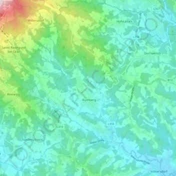
Name: Kumberg topographic map, elevation, terrain.
Location: Kumberg, Bezirk Graz-Umgebung, Styria, 8062, Austria (47.12888 15.50123 47.20062 15.59051)
Average elevation: 551 m
Minimum elevation: 413 m
Maximum elevation: 1,119 m
Make a donation
Gear up for your next adventure:
As an Amazon Associate, this site earns from qualifying purchases at no extra cost to you.
Other topographic maps
Click on a map to view its topography, its elevation and its terrain.
Sankt Marein bei Graz
Austria > Styria > Bezirk Graz-Umgebung > St. Marein bei Graz
Average elevation: 395 m
Make a donation
Gear up for your next adventure:
As an Amazon Associate, this site earns from qualifying purchases at no extra cost to you.