
Yuracmayo topographic map
Interactive map
Click on the map to display elevation.
About this map
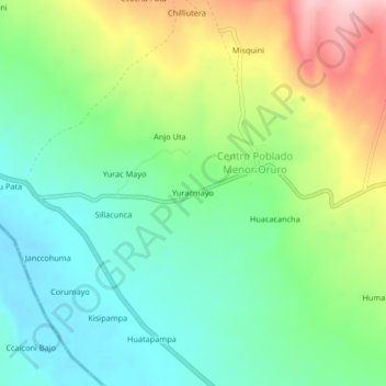
Name: Yuracmayo topographic map, elevation, terrain.
Location: Yuracmayo, Carabaya, Puno, Perú (-14.39271 -69.95753 -14.35271 -69.91753)
Average elevation: 4,232 m
Minimum elevation: 4,155 m
Maximum elevation: 4,377 m