
Ploiești topographic map
Interactive map
Click on the map to display elevation.
About this map
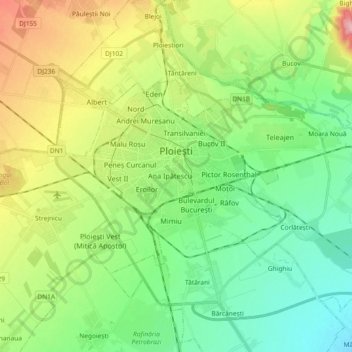
Name: Ploiești topographic map, elevation, terrain.
Location: Ploiești, Prahova, Romania (44.89614 25.91790 44.96842 26.10197)
Average elevation: 158 m
Minimum elevation: 105 m
Maximum elevation: 264 m