Geolocate

Aston topographic map

Click on the map to display elevation.

About this map
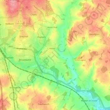
Name: Aston topographic map, elevation, terrain.

Location: Aston, East Hertfordshire, Hertfordshire, England, United Kingdom (51.85320 -0.16118 51.91547 -0.12087)

Average elevation: 99 m

Minimum elevation: 52 m

Maximum elevation: 143 m

Other topographic maps

Click on a map to view its topography, its elevation and its terrain.
Gear up for your next adventure:

🧼Biodegradable Soap - Eco-friendly outdoor soap
📡Portable Emergency Radios - Stay informed about weather warnings and bushfire alerts
🕶️Polarized Outdoor Sunglasses - Reduce glare from rocks and water for better visual navigation
⛺Lightweight Tents - Compact tents for backpacking
🧭Global Orienteering Compass - High-precision liquid-filled compasses for accurate map reading and navigation

As an Amazon Associate, this site earns from qualifying purchases at no extra cost to you.