
Lienisberg topographic map
Interactive map
Click on the map to display elevation.
About this map
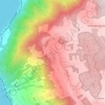
Name: Lienisberg topographic map, elevation, terrain.
Location: Lienisberg, Walchwil, Zug, 6318, Switzerland (47.11431 8.50866 47.13431 8.52866)
Average elevation: 791 m
Minimum elevation: 405 m
Maximum elevation: 1,014 m