
راکاپوشی topographic map
Interactive map
Click on the map to display elevation.
About this map
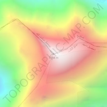
Name: راکاپوشی topographic map, elevation, terrain.
Location: راکاپوشی, Gilgit-Baltistan, Azad Cachemire (36.14227 74.48811 36.14237 74.48821)
Average elevation: 6,882 m
Minimum elevation: 5,876 m
Maximum elevation: 7,704 m
Other topographic maps
Click on a map to view its topography, its elevation and its terrain.
Diran
Pakistan > Gilgit-Baltistan > Gilgit
Diran, Gilgit, Gilgit District, Gilgit-Baltistan, Pakistan
Average elevation: 6,311 m