
Mount Eldee topographic map
Click on the map to display elevation.
About this map
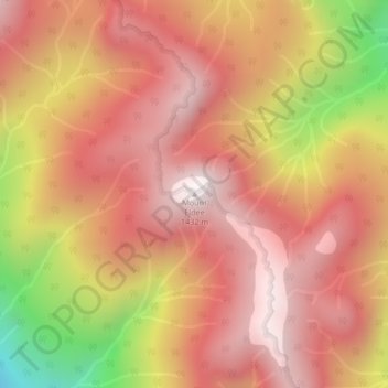
Name: Mount Eldee topographic map, elevation, terrain.
Average elevation: 1,026 m
Minimum elevation: 287 m
Maximum elevation: 1,408 m
Other topographic maps
Click on a map to view its topography, its elevation and its terrain.
University of British Columbia
Canada > British Columbia > Metro Vancouver Regional District > Electoral Area A
Average elevation: 57 m
Indian Arm
Canada > British Columbia > Metro Vancouver Regional District > Electoral Area A
Average elevation: 463 m
Lower Seymour Conservation Reserve
Canada > British Columbia > Metro Vancouver Regional District > Electoral Area A
Average elevation: 605 m
Pitt Lake
Canada > British Columbia > Metro Vancouver Regional District > Electoral Area A
Average elevation: 659 m
Barnes Lake
Canada > British Columbia > Metro Vancouver Regional District > Electoral Area A
Average elevation: 1,277 m
Wreck Beach
Canada > British Columbia > Metro Vancouver Regional District > Electoral Area A
Average elevation: 32 m
Tower Beach
Canada > British Columbia > Metro Vancouver Regional District > Electoral Area A
Average elevation: 27 m
Capilano River
Canada > British Columbia > Metro Vancouver Regional District > Electoral Area A
Average elevation: 596 m
Barnston Island
Canada > British Columbia > Metro Vancouver Regional District > Electoral Area A
Average elevation: 6 m
Pacific Spirit Regional Park
Canada > British Columbia > Metro Vancouver Regional District > Electoral Area A
Average elevation: 56 m
Passage Island
Canada > British Columbia > Metro Vancouver Regional District > Electoral Area A
Average elevation: 0 m
Nitobe Memorial Garden
Canada > British Columbia > Metro Vancouver Regional District > Electoral Area A
Average elevation: 36 m
Seymour River
Canada > British Columbia > Metro Vancouver Regional District > Electoral Area A
Average elevation: 490 m
University of British Columbia
Canada > British Columbia > Metro Vancouver Regional District > Electoral Area A
Average elevation: 64 m