
Estipac topographic map
Interactive map
Click on the map to display elevation.
About this map
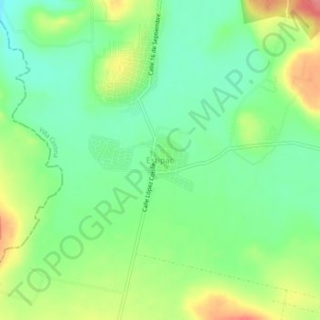
Name: Estipac topographic map, elevation, terrain.
Location: Estipac, Villa Corona, Jalisco, 45740, México (20.34194 -103.74443 20.38194 -103.70443)
Average elevation: 1,378 m
Minimum elevation: 1,345 m
Maximum elevation: 1,432 m
Other topographic maps
Click on a map to view its topography, its elevation and its terrain.
Estipac
México > Jalisco > Villa Corona > Estipac
Estipac, Villa Corona, Jalisco, México
Average elevation: 1,374 m