
Lowther topographic map
Click on the map to display elevation.
About this map
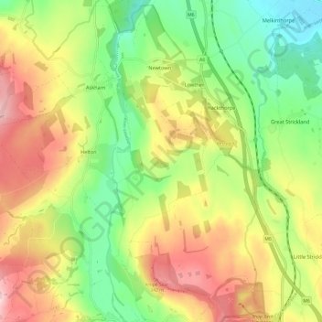
Name: Lowther topographic map, elevation, terrain.
Location: Lowther, Westmorland and Furness, England, United Kingdom (54.55603 -2.74996 54.62443 -2.66842)
Average elevation: 233 m
Minimum elevation: 120 m
Maximum elevation: 371 m
Other topographic maps
Click on a map to view its topography, its elevation and its terrain.