Geolocate

Crotone topographic map

Click on the map to display elevation.

About this map
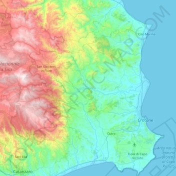
Name: Crotone topographic map, elevation, terrain.

Location: Crotone, Calabria, Italy (38.89247 16.61302 39.48244 17.20643)

Average elevation: 456 m

Minimum elevation: -1 m

Maximum elevation: 1,854 m

Gear up for your next adventure:

🧢Outdoor Sun Hats - Sun protection hats for hiking
📕Australia Maps - Maps covering Australian regions
🪢550 Survival Paracord - Versatile cordage for gear repair and emergency lashing
🔭Compact Hiking Binoculars - Lightweight optics for scouting routes or birdwatching
⌚Altimeter Barometer Watches - Outdoor watches with built-in sensors to track altitude changes and weather shifts

As an Amazon Associate, this site earns from qualifying purchases at no extra cost to you.