
Garbic topographic map
Interactive map
Click on the map to display elevation.
About this map
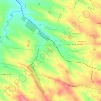
Name: Garbic topographic map, elevation, terrain.
Average elevation: 200 m
Minimum elevation: 151 m
Maximum elevation: 246 m
Other topographic maps
Click on a map to view its topography, its elevation and its terrain.
A En Berrete
France > Occitanie > Gers > Monferran-Savès > A En Saboie
A En Berrete, A En Saboie, Monferran-Savès, Auch, Gers, Occitanie, France métropolitaine, 32490, France
Average elevation: 191 m