
Bârlad topographic map
Interactive map
Click on the map to display elevation.
About this map
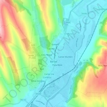
Name: Bârlad topographic map, elevation, terrain.
Location: Bârlad, Vaslui, Romania (46.19421 27.64138 46.27249 27.70310)
Average elevation: 122 m
Minimum elevation: 63 m
Maximum elevation: 264 m
Other topographic maps
Click on a map to view its topography, its elevation and its terrain.