Geolocate

Alpena topographic map

Click on the map to display elevation.

About this map

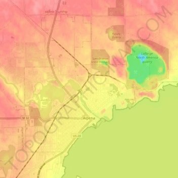
Name: Alpena topographic map, elevation, terrain.

Location: Alpena, Alpena County, Michigan, 49707, United States (45.04200 -83.47664 45.10595 -83.36919)

Average elevation: 185 m

Minimum elevation: 134 m

Maximum elevation: 209 m

Gear up for your next adventure:

🎒3L Hydration Reservoirs - Hands-free drinking to stay hydrated on steep contour climbs
🎒40L Day Hiking Backpacks - Comfortable packs with hydration support for long days exploring topographic peaks
GPS Watches - GPS watches for outdoor sports
🕯️Emergency Whistles - Safety whistles for hiking
🔪Outdoor Multi-tools - Versatile tools for gear repair and survival tasks in the wilderness

As an Amazon Associate, this site earns from qualifying purchases at no extra cost to you.