
Thank you for supporting this site ❤️
Make a donation
Make a donation
Gear up for your next adventure:
As an Amazon Associate, this site earns from qualifying purchases at no extra cost to you.
Tryfan topographic map
Click on the map to display elevation.
Thank you for supporting this site ❤️
Make a donation
Make a donation
Gear up for your next adventure:
As an Amazon Associate, this site earns from qualifying purchases at no extra cost to you.
About this map
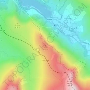
Name: Tryfan topographic map, elevation, terrain.
Location: Tryfan, Nant Peris, Gwynedd, Wales, LL55 4UE, United Kingdom (53.09940 -4.09627 53.09950 -4.09617)
Average elevation: 333 m
Minimum elevation: 92 m
Maximum elevation: 740 m
Thank you for supporting this site ❤️
Make a donation
Make a donation
Gear up for your next adventure:
As an Amazon Associate, this site earns from qualifying purchases at no extra cost to you.