
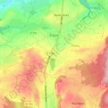
Eclose topographic map
Interactive map
Click on the map to display elevation.
About this map
Name: Eclose topographic map, elevation, terrain.
Average elevation: 549 m
Minimum elevation: 442 m
Maximum elevation: 649 m
Other topographic maps
Click on a map to view its topography, its elevation and its terrain.
Badinières
France > Auvergne-Rhône-Alpes > Isère > Eclose-Badinières
Badinières, Eclose-Badinières, La Tour-du-Pin, Isère, Auvergne-Rhône-Alpes, France métropolitaine, 38300, France
Average elevation: 492 m