Geolocate

Odell topographic map

Click on the map to display elevation.

About this map

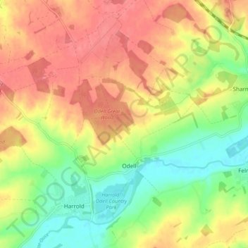
Name: Odell topographic map, elevation, terrain.

Location: Odell, Bedford, England, United Kingdom (52.19804 -0.63704 52.23870 -0.55482)

Average elevation: 76 m

Minimum elevation: 38 m

Maximum elevation: 109 m

Gear up for your next adventure:

🔥Windproof Plasma Lighters - USB rechargeable lighters that work in high-altitude winds
🧯Animal Deterrent Spray - Safety spray for wildlife
🧥Thermal Emergency Blankets - Compact Mylar blankets to prevent hypothermia if stranded overnight
👟Lightweight Trail Runners - Agile footwear for fast movement over rugged Australian terrain
🐍Australian Snake Bite Kits - Specific pressure immobilization bandages for Australian venomous snakes

As an Amazon Associate, this site earns from qualifying purchases at no extra cost to you.