Geolocate

Binucayan topographic map

Click on the map to display elevation.

About this map

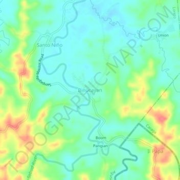
Name: Binucayan topographic map, elevation, terrain.

Location: Binucayan, Agusan del Sur, Caraga, Philippines (7.98990 125.79959 8.02990 125.83959)

Average elevation: 48 m

Minimum elevation: 27 m

Maximum elevation: 91 m

Gear up for your next adventure:

🥾Hiking Boots - Durable hiking boots for trails and rough terrain
🗺️Topographic Maps - Detailed maps for hiking and navigation
🕯️Emergency Whistles - Safety whistles for hiking
🛌Sleeping Mats - Insulated mats for camping comfort
🧢Wide Brim Sun Hats - Maximum coverage for the face and neck while out in the open

As an Amazon Associate, this site earns from qualifying purchases at no extra cost to you.