Geolocate

Barnston topographic map

Click on the map to display elevation.

About this map
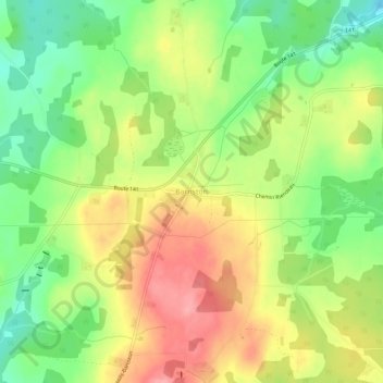
Name: Barnston topographic map, elevation, terrain.

Location: Barnston, Coaticook, Coaticook (MRC), Estrie, Quebec, Canada (45.08738 -71.90275 45.12738 -71.86275)

Average elevation: 418 m

Minimum elevation: 366 m

Maximum elevation: 474 m

Gear up for your next adventure:

🚁Camera Drones with GPS - Capture aerial views of the landscape to compare with topo maps
⌚Altimeter Barometer Watches - Outdoor watches with built-in sensors to track altitude changes and weather shifts
📚Map Reading & Navigation Guides - Master the art of interpreting topographic contours and symbols
🧥Thermal Emergency Blankets - Compact Mylar blankets to prevent hypothermia if stranded overnight
🦯Trekking Poles - Walking poles for hiking stability

As an Amazon Associate, this site earns from qualifying purchases at no extra cost to you.