Geolocate

Wroclaw topographic map

Click on the map to display elevation.

About this map

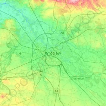
Name: Wroclaw topographic map, elevation, terrain.

Location: Wroclaw, Wrocław, Lower Silesian Voivodeship, 50-001, Poland (50.94898 16.87267 51.26898 17.19267)

Average elevation: 130 m

Minimum elevation: 99 m

Maximum elevation: 233 m

Gear up for your next adventure:

🔪Camping Knives - Multi-purpose outdoor knives
🔪Outdoor Multi-tools - Versatile tools for gear repair and survival tasks in the wilderness
🧦Merino Wool Hiking Socks - Moisture-wicking socks to prevent blisters during long topographic surveys
🎒Daypacks - Compact backpacks for short hikes
🩹First Aid Kits - Emergency kits for hiking

As an Amazon Associate, this site earns from qualifying purchases at no extra cost to you.