Geolocate

Leeds topographic map

Click on the map to display elevation.

About this map

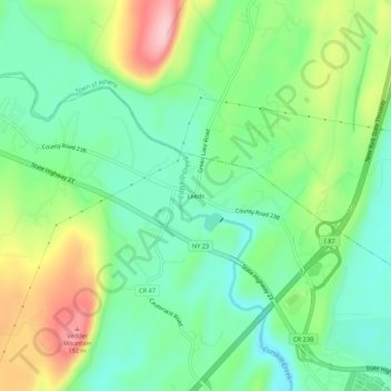
Name: Leeds topographic map, elevation, terrain.

Location: Leeds, Town of Catskill, Greene County, New York, 12414, United States (42.23537 -73.92235 42.27537 -73.88235)

Average elevation: 73 m

Minimum elevation: 5 m

Maximum elevation: 203 m

Other topographic maps

Click on a map to view its topography, its elevation and its terrain.

Gear up for your next adventure:

👣Snake & Scrub Gaiters - Protection against spinifex, mud, and snakes while walking off-track
🍴Titanium Spork & Cutlery - Indestructible and feather-light eating utensils
🧣Merino Neck Gaiters - Versatile headwear for warmth, sun protection, or dust filtering
🦯Adjustable Trekking Poles - Reduce impact on knees when descending steep topographic ridges
📻Handheld UHF Radios - Critical communication for groups in the Australian outback

As an Amazon Associate, this site earns from qualifying purchases at no extra cost to you.